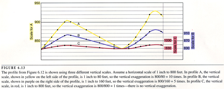
The topographic profile is usually drawn with a larger scale than the horizontal scale.
The topographic profile is usually drawn with a larger scale than the horizontal scale.
This vertical exaggeration emphasizes topographic features.
To calculate the vertical exaggeration of a profile, first convert the horizontal and vertical scales of the profile to the same units.
For example, the horizontal scale is 1” to 1 mile = 1” to 5280’.]
The vertical scale is 1/8” to 20’ = 1” to `60’.
Next, divide the number of feet per inch in the horizontal scale by the number of feet per inch in the vertical scale: 5280/160 = 33.