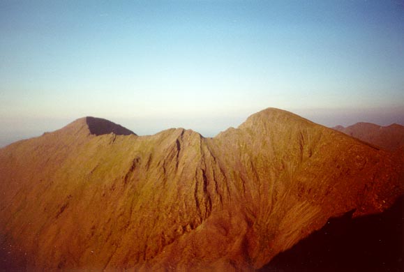
Carrauntoohil (right) and Beenkerragh, Ireland's two highest peaks; the dramatic ridge connecting them is viewed at sunset.
Carrauntoohil (right) and Beenkerragh, Ireland's two highest peaks; the dramatic ridge connecting them is viewed at sunset.
Carrauntoohil is located in the MacGillycuddy Reeks, the mountain range that dominates the Ivreagh peninsula in west Kerry, in the southwest of Ireland. 'Though only just over 1000 meters high, Carrauntoohil presents enough challanges to make it as difficult as many higher mountains elsewhere - the going is rough and steep, and the Ivreagh peninsula's distinction of being the first mass of land that the prevailing southwesterly winds see for thousands of miles means that the weather can change from bright and sunny to sodden with visibilty nil in a matter of minutes!
My first serious attempt at Carrauntoohil, in the summer of 1998, was a complete disaster. The clouds were down below 200 meters, and neither myself nor my two partners were particularly enthusiastic; we reached Loch Eighter, made a cup of tea, sat around for a while skimming stones, then turned around and went home.
My second attempt was a year later; this time, conditions were better - the cloud line was at 300 meters! But unlike the previous year, my partner and I were all fired up, and we didn't let the zero visibility interfere with our enjoyment of the walk (in fact, we let it positively contribute to our enjoyment - we got lost twice, once on the way up, and once on the way down!)
At the end of August 2000, I walked up Carrauntoohil again. It was third time lucky; conditions were perfect, with not a cloud in the sky! It's this trip that I'll document here.
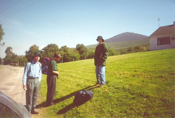
John, Martin and Cornelia, preparing for the off. Skregmore is visible in the background.
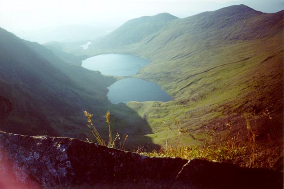
We began at Breanlea, half way along the road between Kilorglan and Glencar. We got up to Loch Eighter by following the water pipe (rather than the hydro road); this route is neither too steep nor too boggy, and is a good warm up for what's to come.
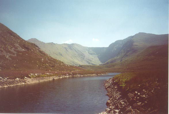
Loch Eighter.
We paused for a while at Loch Eighter (an artificial lake, part of a recent hydroelectric scheme), before taking on the steep climb over the heather to the shoulder of Skregmore, from where the views of the way ahead are magnificent. At the summit of Skregmore (834 meters (2736 feet)), Martin and Cornelia decided to head down into the valley to take a closer look at Coomlougra, leaving just John and myself to carry on towards Carrauntoohil.
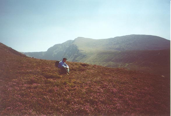
John resting on his way up to the shoulder of Skregmore.
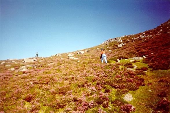
Cornelia crossing the heather, on the way up to the shoulder of Skregmore.
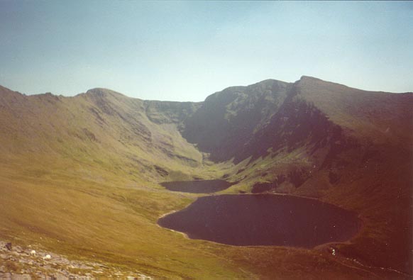
Looking down into the Coomloughra valley from Skregmore.
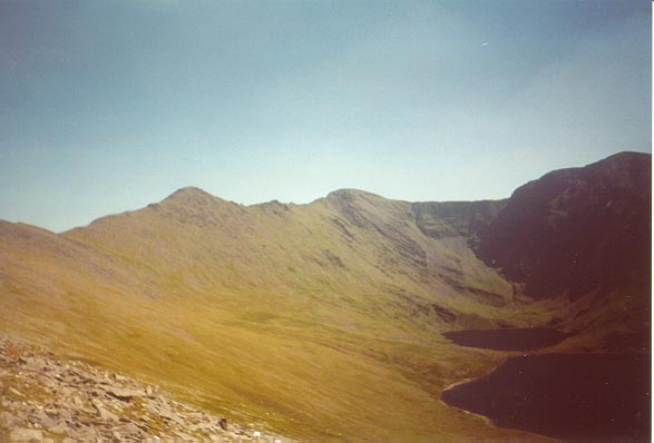
The way ahead, viewed from the start of the shoulder of Skregmore. First, the ridge goes up to Beenkerragh, then accross to Carrauntoohil (which seems smaller than Beenkerragh here; it's a little bit further away), then onto Caher, just visible on the far right.
John making his way up the last rocky slope to the summit of Skregmore.
From Skregmore to Beenkerragh, the path is broad; but between Beenkerragh and Carrauntoohil, it becomes a narrow arete. Making our way gingerly along the Beenkerragh ridge, we got great views down into the Coomloughra valley on our right, and Hag's Glen on our left.
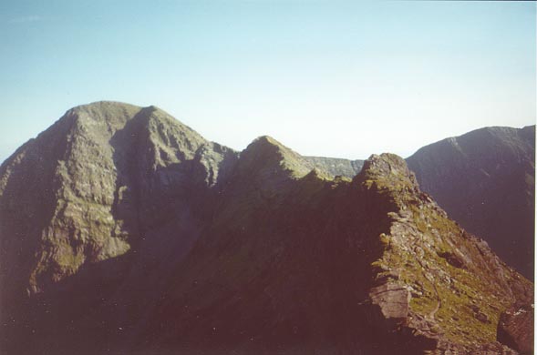
The dramatic knife-edge ridge connecting Beenkerragh to Carrauntoohil.
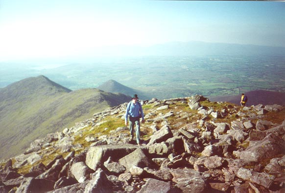
As the arete ends, the steep path to the summit of Carrauntoohil begins. Skregmore and Beenkerragh have many false summits; mercifully, Carrauntoohil doesn't, and we were very pleased to find that the summit came on us quickly. Just like Volcan baru in Panama, the highest point of Ireland is marked with a cross. John and I stood by the cross for a while, enjoying the panoramic view and the fact that we were the highest people in Ireland, until two locals arrived from the Devil's Ladder route (and kindly took a piccy of us).
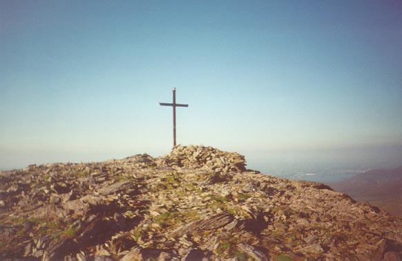
The highest point in Ireland - marked, of course, by a cross. Until recently, a bicycle used to be chained to the cross!
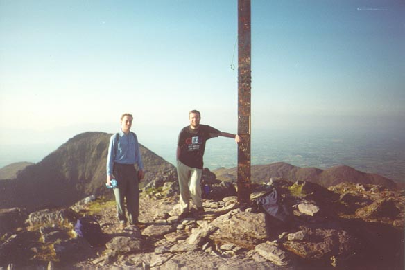
Proof that John and I made it!
From Carrauntoohil, we went along the Caher ridge to the shortest 1000+ meter peak in Ireland - the 1001 meter (3284 feet) Caher. Although all the guidebooks describe the Beenkerragh ridge as the scariest part of the walk ("not for the faint hearted!" warns Joss Lynam), we found that the vertical drop from the Caher ridge down into Coomloughra was much scarier. ('Though it has to be said that viwed from the Caher ridge, the Beenkerragh ridge looks mighty impressive!)
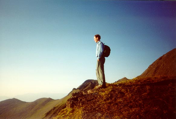
John Of Destiny.
Looking down into Coomloughra, from the Caher ridge
From the summit of Caher, we went down quickly along the boggy shoulder back to Loch Eighter; and, as it was by now dark, we choose to head home along the unneccessarily steep hydro road rather than by the pipeline path (which crosses through open fields).
Back to my personal page.