
Notre Dame's Grotto / by Dorothy V. Corson
Locating St. Angela's Island From the Glen
The description St. Angela's island and its candlelight procession prompted a search of maps of the St. Joseph River to see if the island could still be located, if there was anything left of it. It had been one hundred and thirty-six years since its dedication by Father Moreau.
An aerial view of the Saint Mary's campus taken in 1966 and filed at the County/City Building indicated a small island in approximately the same spot as the 1878 map had shown it. It proved, without a doubt, another bit of campus lore. Now Notre Dame and St. Mary's both had an island.
Time and erosion would account for a change in size. It was not uncommon for an island to appear and disappear over time. The 1966 map also showed a large tree on it. It was probably the same tree mentioned in the description of Father Moreau's visit.
What the glen looked like in its early days, when there were landscaped paths, walks along the river, and flowering shrubs and trees in profusion, could only be imagined. Father Boehm has described the glen, now a wilderness, as a riot of color in the springtime, carpeted with violets and myrtle, daffodils and crocuses, and countless other colorful perennials, planted ages ago. Fragrant lilacs and bright forsythia dot the now wild landscape.
One day, Sister Rosaleen, Saint Mary's College archivist, and a student helper, were going through storage boxes of old photographs in an effort to date them and identify the people in them. They came across a very good matted 81/2 x 11" photograph labeled "St. Angela's Island." At last, no more doubts about it, there it was as clear as any photograph could make it. It is the island photograph in the last episode.
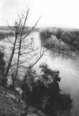
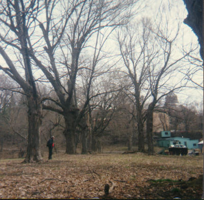
The density of the undergrowth during the summer months made exploring the glen at that time almost impossible. Locating the island from the glen would have to await early spring or fall. The location of the remains of the Grotto was hidden in the undergrowth. It had not been easy to find it. A picture was taken from the grotto, facing toward the buildings on the bluff above the glen, using a turquoise maintenance building as a landmark. When the film was developed an obvious avenue of trees, otherwise not apparent to the eye, appeared in the photograph. The old map revealed a lane leading to the island in the river. Did that avenue of trees border that long unused lane? Would there be anything left of this once lovely island?
Early spring arrived. It was time to locate the island. Brush and brambles led past a huge uprooted tree. Each step had to be anticipated beforehand to avoid ruts and numerous groundhog holes. Further on water could be seen in the distance. The riverbank was closer than expected, possibly 200 feet beyond the abandoned Grotto. Eight to ten feet of water-washed sand separated the mainland from a sandbar with six foot high brush sparsely covering it. Its size was difficult to gage because trees along the shoreline hid it from view. From the glen side of the river, it appeared to be the island, yet there was no dead tree.
Following the riverbank to the north end of the sandbar, resulted in the discovery of the island. It was just as it was pictured in the Sister Rosaleen's St. Angela Island photograph. The small island was so close to the larger sandbar that it looked as if it might have been attached to it at one time.
It was still wooded, as it was in Sister Rosaleen's photograph. There were a few medium-sized trees, and a span of water of perhaps eight feet, which would have required the footbridge noted on the 1878 map. One larger standing tree appeared to be dead. The description of Moreau blessing the island had mentioned the altar being near a large tree. Perhaps this was the same one.
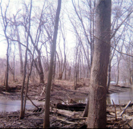
A profusion of crocuses and other plants were sprouting on a slight incline facing the island. Here the Sisters must have pinned up their veils and skirts when they worked in the glen, planting the bulbs, and clearing the underbrush. A climb to the top of a slight incline, which hid the island from view from the college grounds, revealed the avenue of trees. They led directly to the island just as the lane was shown on the 1878 map.
Not only the Grotto in the glen had been located, but also, evidence of all that remained of what must have once been a lovely little island oasis on the Saint Mary's side of the St. Joseph River. The glen and the island must have echoed with young voices and high spirited activity in days gone by. In the 1890s, the river bank had twice been retained with a stone wall to protect the shoreline. Pictures, as late as 1905, show cows being pastured nearby.(215)
Father Carey called the glen at St. Mary's "Perley's glen". He thought its name came from an early family named Perley, who once owned the property. He said they used to go to the glen as young seminarians to avoid the crowds on campus during football games. He painted yet another picture of those early carefree days, this time of male voices echoing through the glen. He said they used to swing from the grapevines over the St. Joseph River. It must have been a perilous sport, considering the swift current in the St. Joseph River.